









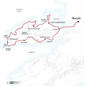
Location County Kerry, Ireland
Start & finishTralee
Distance 179km (111 miles)
Duration Six to 10 days
Challenge Level 2/5
When to Walk April-October
Info thedingleway.ie
Thrusting out into the crashing Atlantic waves, the Dingle Peninsula is home to some of Ireland’s finest scenery – and one of its greatest walks
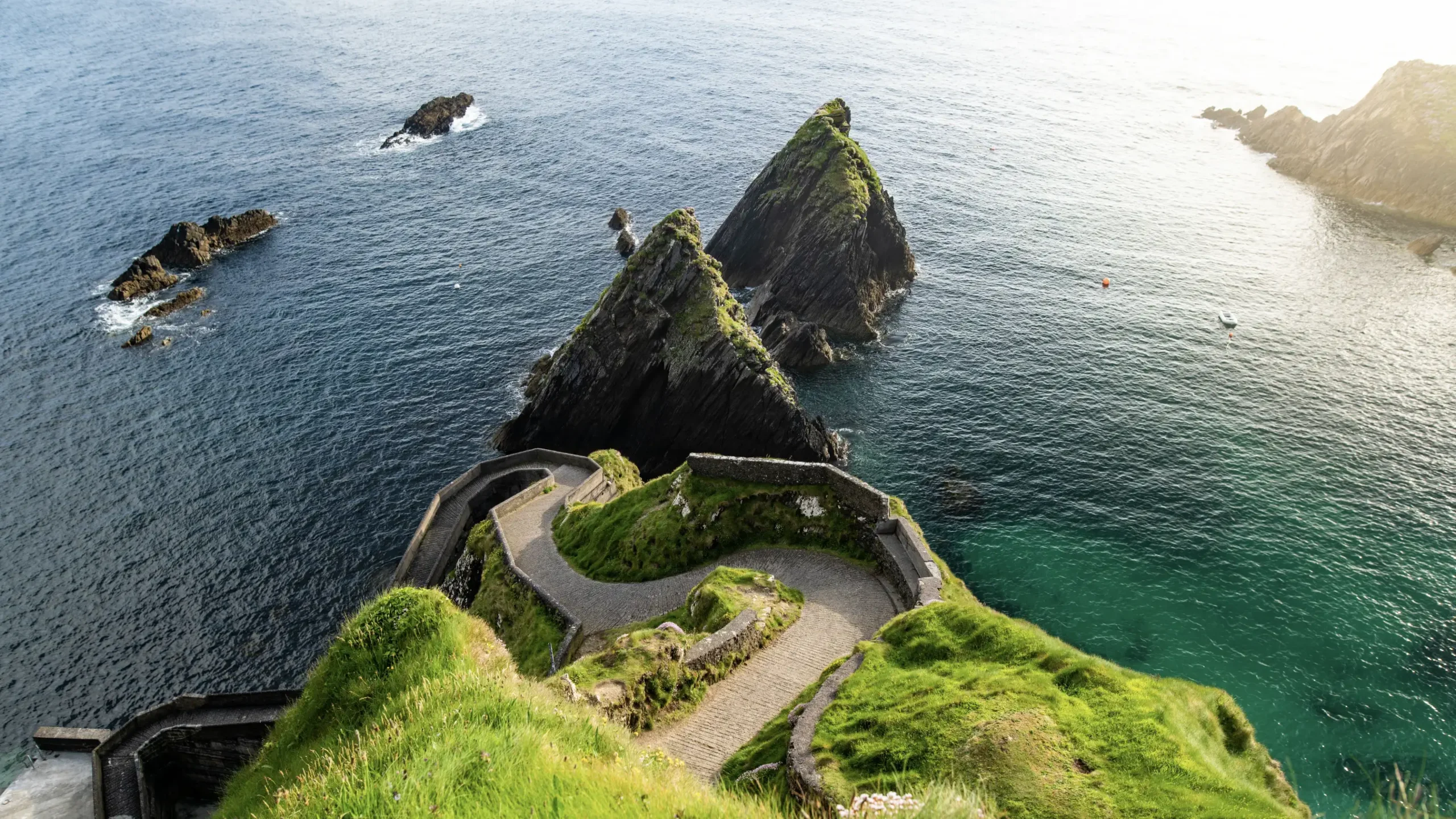
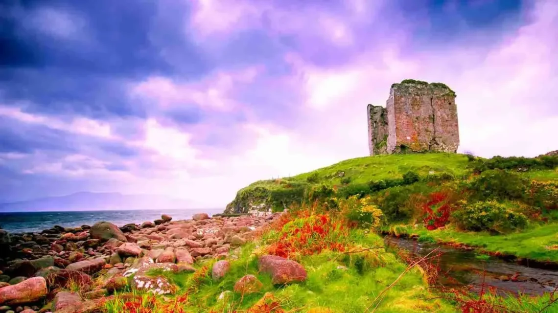
Corca Dhuibhne – the Dingle Peninsula – is Ireland’s wildest west, a rugged finger poking out into the Atlantic at the extreme edge of Europe. It feels remote, elemental and tinged with not a little magic thanks to its ephemeral light, ancient relics and the lilting voices of the Gaeltacht (Gaelic-speaking) community. ‘Fáilte romhat isteach’, they say: ‘You’re most welcome here’.
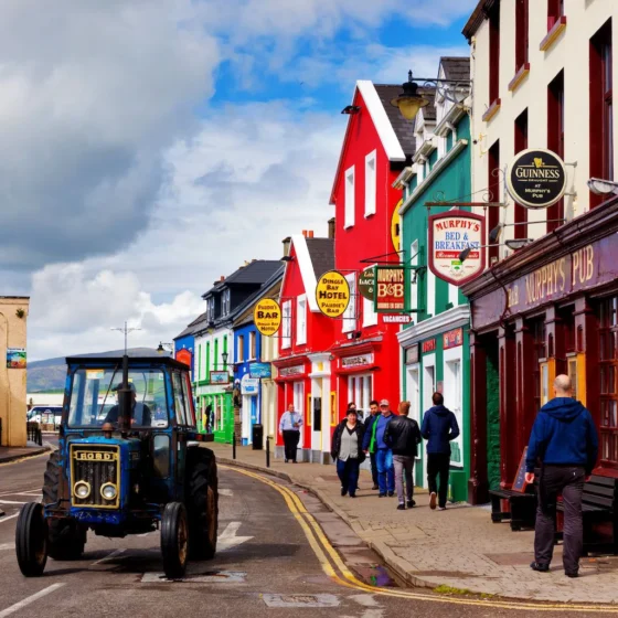
Walkers are especially welcome. The well-marked Dingle Way circuits the peninsula, offering a sort of Ireland in miniature: it passes lively towns, archaeological sites, emerald meadows, relatively formidable peaks, ocean-smacked cliffs, restaurants serving succulent seafood and wonderful old pubs thrumming with Irish tunes.
The trail itself is a mix of well-maintained paths and country lanes that thread between hills, beaches, boulder fields and boggy bits. Rarely too taxing, the most challenging aspect is the changeable weather: it can feel pretty arduous being blasted by the elements. So a visit in late spring or early summer is best for drier, warmer conditions. June in particular offers near-endless days – over 18 hours of daylight on the summer solstice – but sits just before the very peak season, making it easier to secure accommodation and walk without hordes of other people. It’s also a great time for cetacean-spotting, from both boat and land. Gaze out from clifftop vantage points like Slea Head and Clogher Head and you might spy common dolphins, minke whales or even humpbacks. And from March to July, puffins are burrowing nests on the Blasket Islands, too.
Walking back in time
Next, it’s out onto wide, open, bird-twittered moorland to reach the market town of Kirkby Stephen and enter the Yorkshire Dales proper, studded with ancient cairns, tinkling waterfalls, stone-built villages (with accompanying tea shops) and the sweeping River Swale. Richmond (meaning ‘strong hill’) is an historic town with a Norman castle and plenty of places to rest and refuel.
Across the North York Moors National Park – the final stretch – lie the remains of Mt Grace Priory (England’s best-preserved Carthusian monastery), the Bronze Age burial mound at Cringle Moor and swathes of windswept, heather-flecked uplands that, eventually, afford views to the sea. The finale is along the River Esk, past Grosmont’s steam-pulled North Yorkshire Moors Railway and along the cliffs before dropping into the hill-clinging fishing village of Robin Hood’s Bay – where, as custom dictates, a further toe-dunk in the North Sea bookends your hike.
Wainwright divided his walk into 12 stages. Tackling one per day is doable but tough, especially over the challenging Lakeland section. Taking it slower makes for a more manageable adventure, as does walking before winter sets in, the moors become bleaker and the fells more treacherous. Summer enjoys the warmest temperatures, of course – but hiking in autumn means emptier trails, better accommodation availability, blackberries bursting from the hedgerows, and turning foliage setting the countryside aflame with a full Pantone chart of purples, reds and yellows.
Get involved
Extract taken from Lonely Planet’s Where To Go When Hiking, written by Sarah Baxter and Paul Bloomfield. Discover 96 spectacular hiking trails around the world and the best times to explore them in this inspiring month-by-month trip planner.